Seattle’s comprehensive plan promises to build more housing along frequent transit corridors, without offering many details on where that housing would be located. Based on an analysis of draft zoning maps, I found that within the low-density residential neighborhoods that cover most of Seattle:
- The comprehensive plan would upzone fewer than 1 in 10 parcels within a five-minute walk of transit stops.
- Almost all of the added capacity would be concentrated along hazardous arterial streets, without specific commitments to safety improvements along those streets.
Seattle deserves smarter and safer growth along our transit corridors.
The One Seattle Plan’s arterial rezones
Seattle’s comprehensive plan is finally headed to City Council this May in the form of draft zoning legislation. As both an important policy document and a proxy for fundamental debates about Seattle’s future, the One Seattle Plan has sparked passionate discussions over the past two and a half years of community engagement.
Since 2022, The Urbanist has shared viewpoints about the plan’s many downstream effects, ranging from Seattle’s supply of accessible and affordable housing to the health of our orcas and tree canopy. These conversations are most productive when the city has laid out a well-defined proposal that the public can react to: for example, after the draft comprehensive plan laid out specific boundaries for 30 proposed Neighborhood Centers, that list became one of the most-discussed items at the plan’s first public hearing in February.
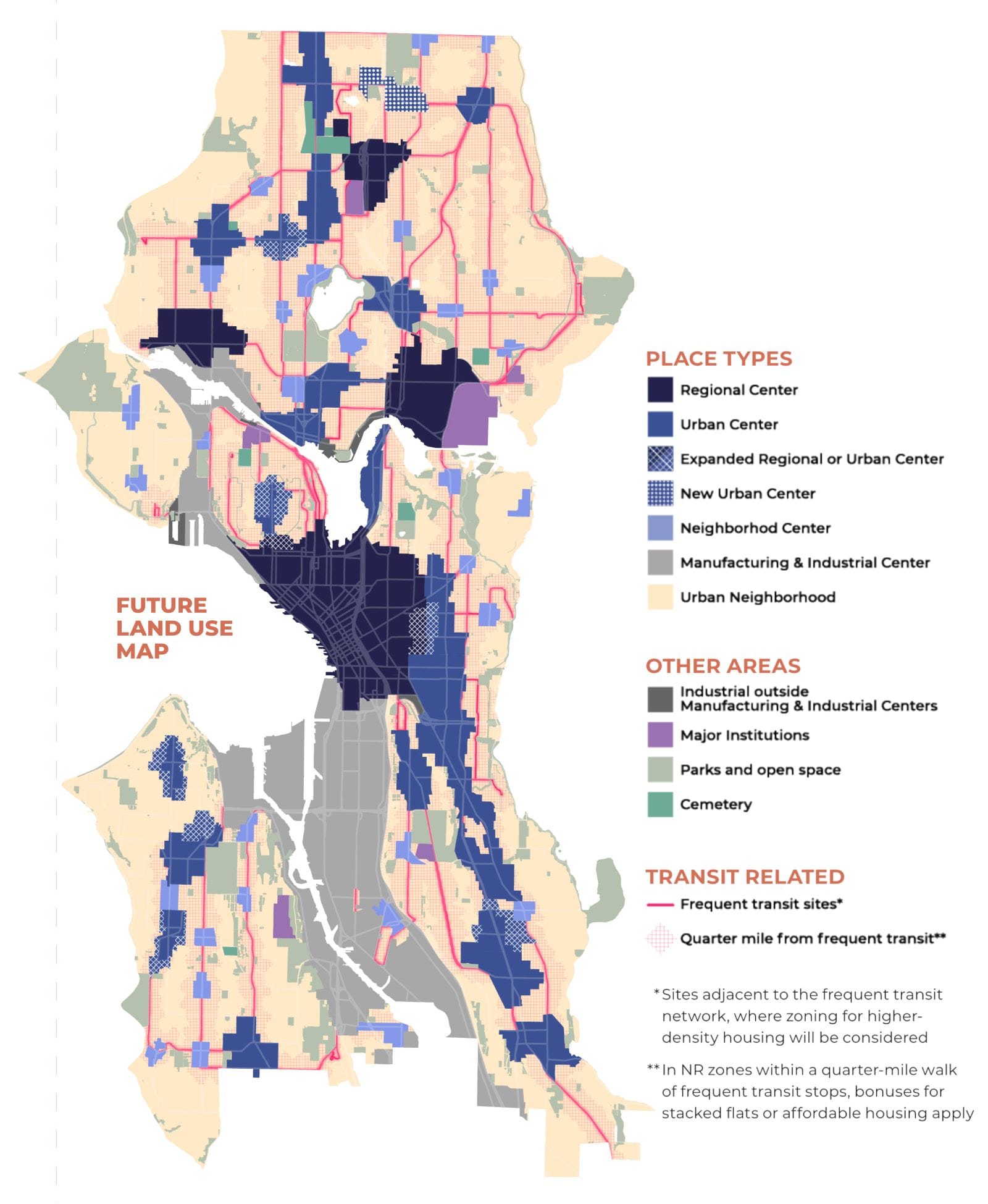
Compared with new Neighborhood Centers, the implications of “select arterial rezones along frequent transit routes” have received far less media attention. How should we interpret the scope of the planned rezones along these routes?
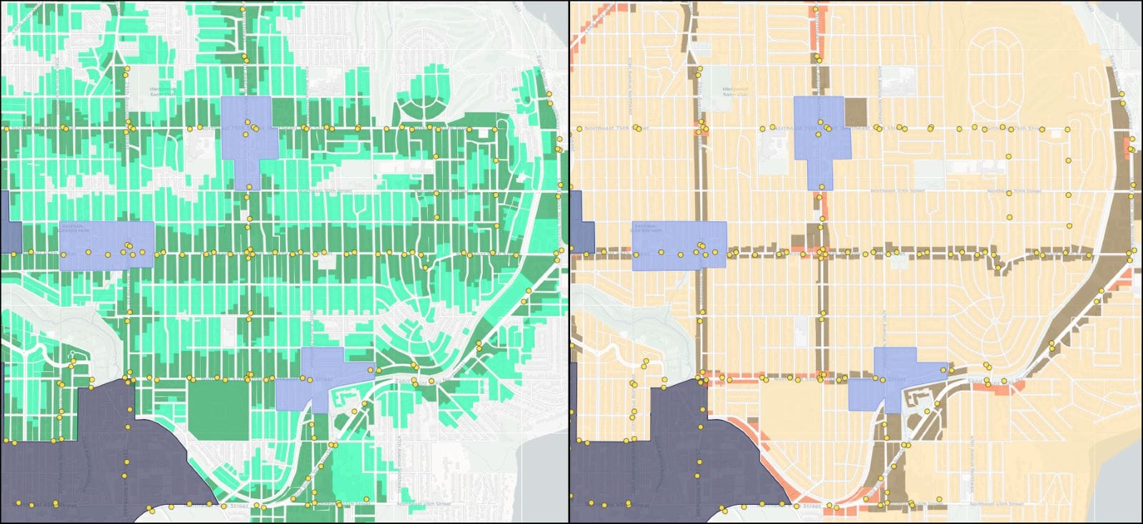
To answer that question, I created side-by-side maps that compare access to transit with the One Seattle Plan draft zoning map, released in October 2024. At the top, you can toggle between different types of transit routes:
- Service Frequency: Filter to routes with 15-minute frequencies or better during peak commuting hours (7-9 am and 5-7 pm)
- Route Connections: Filter to routes that connect to downtown Seattle, any Regional Center (including downtown), or the light rail
Your selections control two maps below:
- Proximity to transit: This map shows parcels within a five-minute walkshed of transit stops on the selected routes. Selected transit stops are shown as yellow dots; parcels within a two-minute walkshed are highlighted in dark green; and parcels within a three to five-minute walkshed are highlighted in light green.
- One Seattle Plan proposed zoning: This map shows the proposed future zoning for each parcel as of October 2024. You can mouse over or tap on the map to see the current zoning and proposed future zoning for that parcel.
These interactive tools show proposed zoning changes in “Urban Neighborhoods,” the City’s designation for formerly single-family neighborhoods, which will soon allow a wider range of housing options thanks to statewide zoning reform. The tools exclude blocks already contained within Regional Centers, Urban Centers, or Neighborhood Centers. Industrial zones and publicly-owned parcels are also excluded.