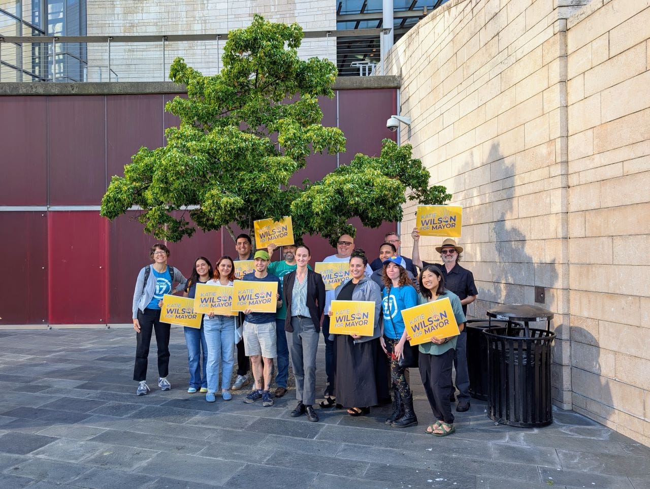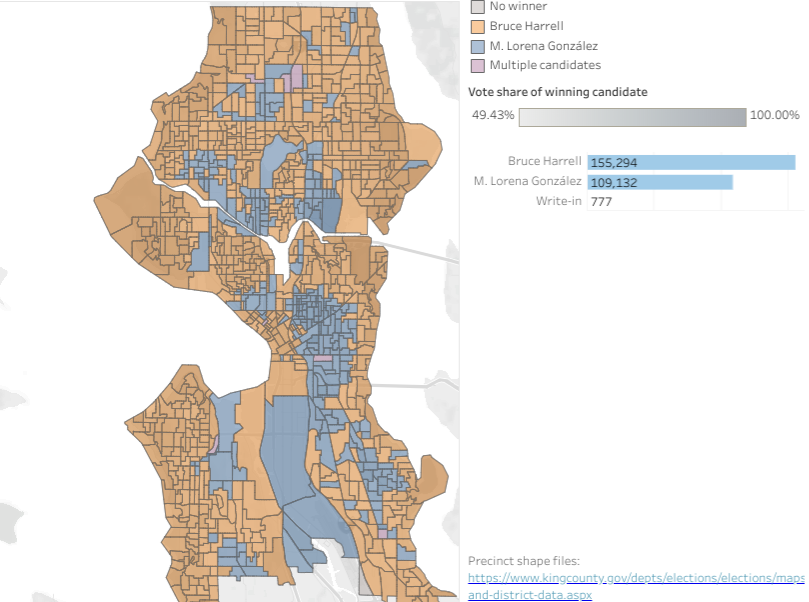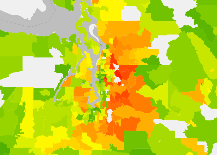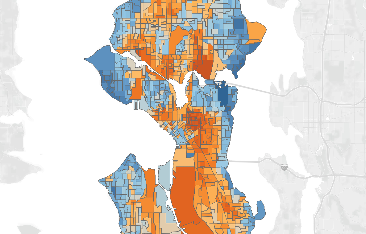
Katie Wilson’s Path to Election Victory, Precinct by Precinct
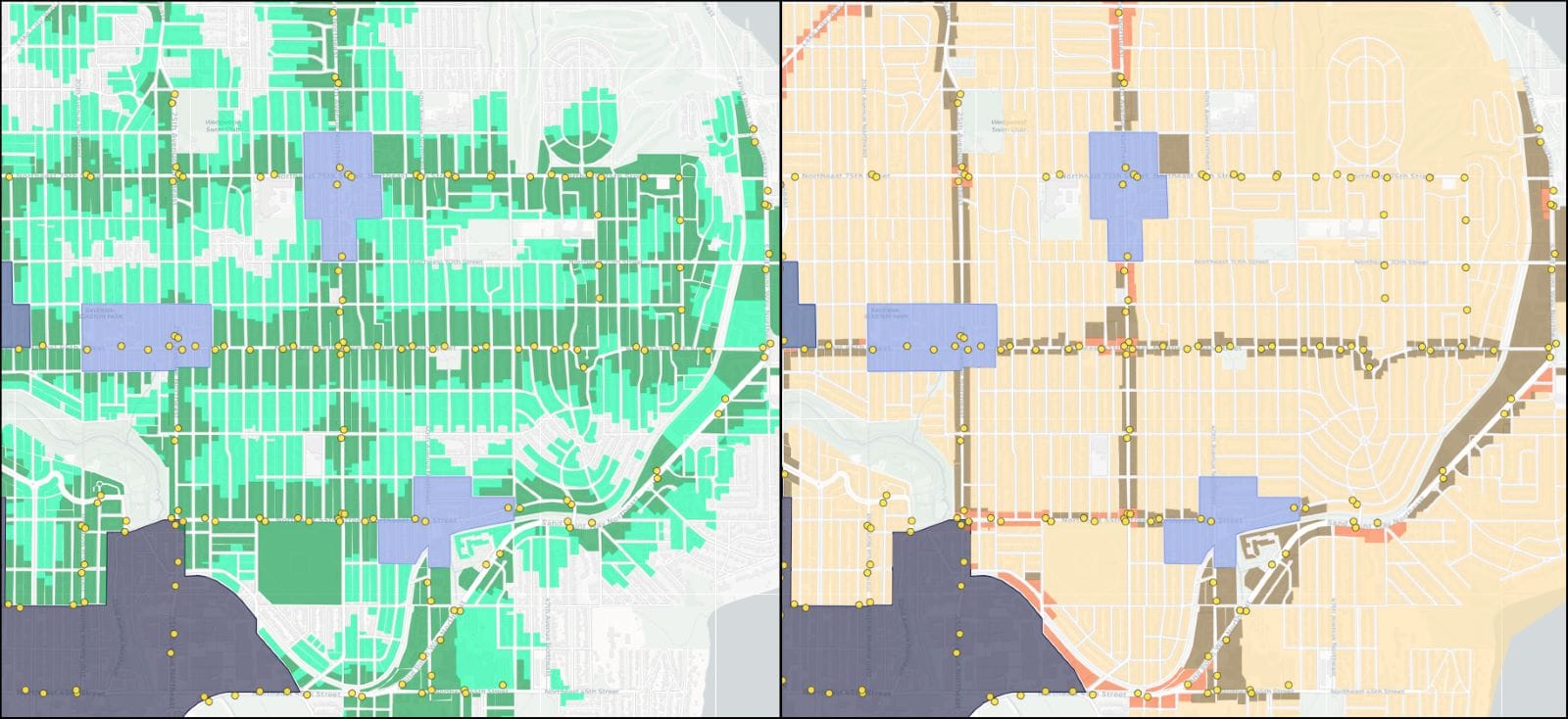
Precinct-level results maps show that Seattle Mayor-Elect Katie Wilson’s path to victory ran through Capitol Hill, the Central District, and the Rainier Valley, where she ran up her vote share.