Transit App is making another leap forward in the world of real-time arrival information. The software already plugs into real-time transit data where available, but its lacking in many places, in part due to transit agencies hoarding their data (hey, Community Transit!) but also because it may not exist at all. That’s left Transit App with only one option: scheduled data as a fallback. In Transit App’s own backyard of Montréal, real-time data is almost non-existent across the whole metropolitan region.
But even when there is real-time data, it may not be perfect. In many places, real-time data can be spotty: channeled for some routes and none for others. Or low frequencies of data getting communicated from vehicles leads to inaccurate arrival times when traffic snarls up, as it is wont to do in Seattle.
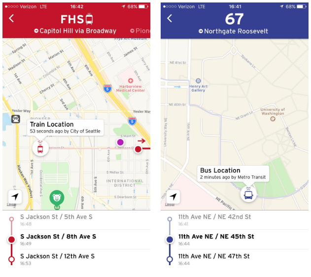
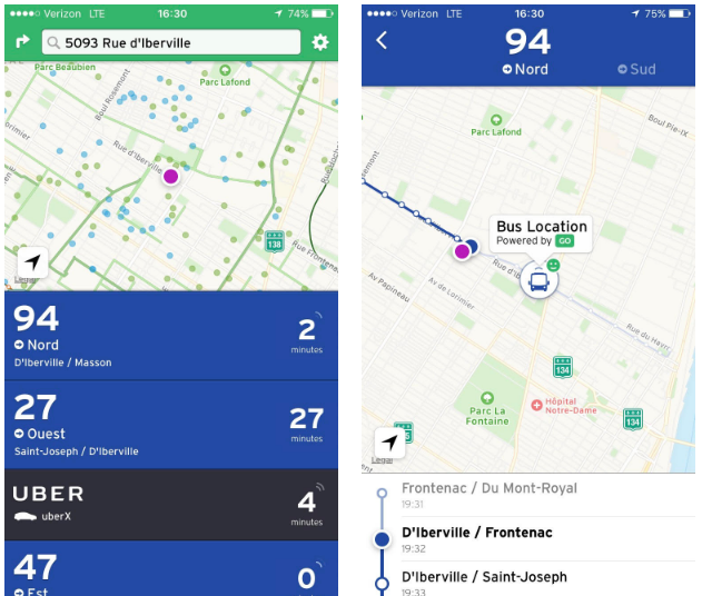
The techies at Transit App, however, have worked up a new solution that could not only serve as a patch for scheduled data scenarios, but also improve the overall quality of real-time data in absolute terms. That’s where crowdsourced real-time arrival data comes into play. Earlier in the fall, Transit App launched a new navigation feature called “GO”. The feature works a lot like any other navigation system (e.g., Google Maps, TomTom, and Wayze) on the market, except that it is tuned in specifically for transit and has a few more bells and whistles.
Transit App 4.0: Transit Navigation Revolutionized